

![]()
Did you know that there is a path that links two of the most beautiful Italian squares? It is the Via degli Dei.
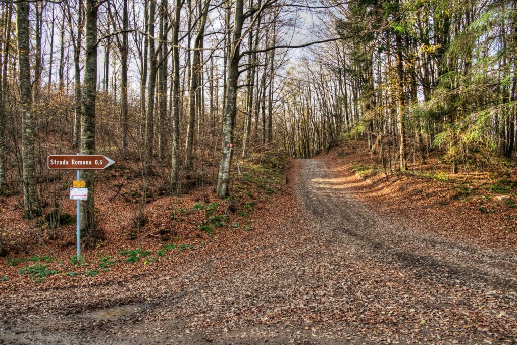
Discover with us the beauty of this 120km long itinerary among the nature of the Apennines, exploring many beauties, such as the Riserva Naturalistica del Contrafforte Pliocenico, the Flaminia Militare, the Castello del Trebbio, the Santuario del Monte Senario and the city of Fiesole, a small but pretty hamlet, among the hills of Florence that once were Etruscan. What are the stages of the path?
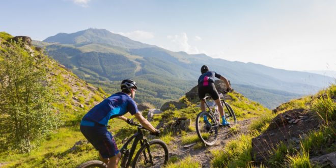
Is it better to go by foot or mountain biking? Find out with us the answers and more!
The story
The Via degli Dei is a path that connects Tuscany and Emilia-Romagna and it boasts a very ancient history. In fact, the first who ventured in the Apennine Mountains were the Etruscan people. Between the 7th and the 4th century BC, they discovered the pass that let them expand their traffics and domains in the Pianura Padana.
Speaking of Etruscan people, did you know that they invented what now is the lasagna alla bolognese? Discover more in our article Fresh pasta: the art of bolognese grannies.
In 187 BC the Romans built on this track the Flaminia Militare, a real street, with all the requirements that allowed the passage of troops, wagons and supplies. Indeed, its goal was to connect the cities of Bononia (Bologna) and Arretium (Arezzo), so that they could quickly pass the Appennines and have access to the Pianura Padana. To this extent the troops and freights movements were simplified, as the expansion to the North was. The name Flaminia is in honor of the Consul Caio Flaminio, who decided to build the path.
During the Middle Ages, wayfarers and merchants took this route as well, but it was gradually abandoned due to the absence of maintenance. Tragically, during World War II it became a place of combat: in 1944 on this trail the german army built the Linea Gotica, a line of defence from the Allies.
A part from this memory, the route was almost forgotten among centuries and was covered by the vegetation of the beech forest.
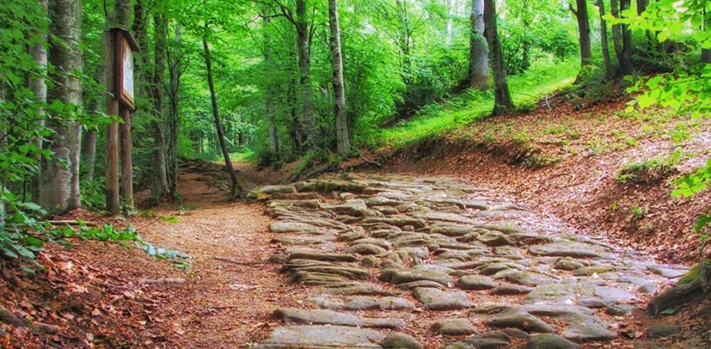
In the latest Seventies it was brought back to light thanks to Cesare Agostini and Franco Santi, that dig and found these remains. In fact, the two amateur archaeologists were intrigued by the narrations of their grandparents, therefore they decided to explore this territory. One of them found a roman coin that confirmed the hypothesis of the roman path. As a second proof, they measured the width of the pavement, and it observed the canonic eight feet (2,40 meters).
Agostini and Santi had to face the opposition of many experts, according to whom the path had to be elsewhere – but was never found. It is thanks to these two curious men that now every year more than ten thousand people explore the Via degli Dei.
The right attitude of the experience
According to a legend, in the early Nineties there was a group of Bolognese friends who were into trekking and fine cuisine.
One day they founded the association Dû pas e na gran magnè (a walk and a great meal). Their goal was to reach Florence by foot and eat in the best taverns along the road.
It is why, according to them, this journey must be done with goliardic attitude, enjoying the pleasure of adventure and company, plunged into nature.
The origins of the name
As we know the original name was different from the actual one. Let’s discover how and why it changed.
“Via degli Dei” literally means “Path of Gods”. Because of this, many people believe it is a religious journey, but it is not. In fact, the name of this 120 kilometers long itinerary is due to the fact that the walk goes through mountains and locations named after Roman divinities. For instance, some of these are Adone (Adonis), Venere (Venus) and Luario (after Lua, the roman goddess of atonement).
Also, the small municipality of Monzuno is named after Juno: it derives from the Latin expression Mons Junonis (Juno’s Mountain), but today it is difficult to catch the connection.
Therefore, even though it has no religious value, its name clearly refers to paganism.
The journey
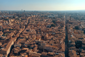
The Via degli Dei connects Piazza Maggiore and Piazza della Signoria, two Italian treasures of art and culture. Everybody is free to begin in the city they prefer. We will illustrate the journey starting from Bologna, the chief town of Emilia-Romagna with its 40 km of porticoes, a Unesco heritage.
After the main square, the path follows San Luca’s 666 arches: the longest porticoes in the world. It leads to the Sanctuary of the Madonna of San Luca, situated on the top of the hills. It is here, among the Bolognese nature, that the Via degli Dei begins. If you want to know more about the porticoes of Bologna, check this article The porticoes of Bologna: a UNESCO World Heritage.
Usually, people go either by foot or mountain biking. If you want to walk, your journey will last from four to six days, while if you decide to ride your bike, you will probably reach Florence in about two or three days.
If you are not an expert of this kind of way, we strongly suggest you join a group and not go alone.
While by walking at least 30 km each day, you will complete the path in 4 days; without any interruption, you will maintain an average of eight or nine hours of travel. While if you decide to take it easier and finish it in at least five days, you can avoid the struggle by walking about 24 km each day.
Lastly, while evaluating and planning your trip, be aware of the fact that autumn and winter have much more reduced solar hours than spring and summer. In these two seasons you will have more possibilities of taking a break along the walk.
The equipment
The journey is challenging but with a good organisation it is absolutely feasible. In fact, most people can do it, but it is important to be prepared and have the right equipment.
First of all, it is fundamental to have a backpack that allows good load distribution, otherwise your body will suffer. Secondly, you need to have hiking boots and, why not, telescopic poles. To hydrate your body, it is important to bring a good supply of water, so that you do not run out of it.
Also, the Apennines can be tricky: downpours are always behind the corner. So be prepared! Bring with you rain equipment, such as raincoat and gaiters.
Last but not least, make sure you do not forget the map! We suggest bringing the paper version, so that if your phone has no more battery, you are still able to find your way around.
The itinerary and its stages
The itinerary offers very different territories with a wide variety of landscapes and characteristics.
It all begins in a cityscape, but then it passes through hamlets, castles and convents, up to when you’re completely surrounded by nature. And you are halfway there. Then, it all gradually returns to be urbanized, and you will find yourself in Florence.
Stage 1 – From Piazza Maggiore to the Sanctuary of the Madonna of San Luca
After admiring the beauty of this main square, you take via D’Azeglio and you will walk past Lucio Dalla’s house. Speaking of whom, did you know that Bologna is the city of music? Check it out in our article!
Then in a few minutes you can reach the porticoes of Saragozza, starting from Arco Bonaccorsi, the first arch. After a steep uphill, you reach the Basilica and you must spend a few minutes to admire the beautiful cityscape. Do you want to know more about San Luca? See also The Sanctuary of the Madonna of San Luca between sacred and legend.
Stage 2 – From San Luca to Sasso Marconi
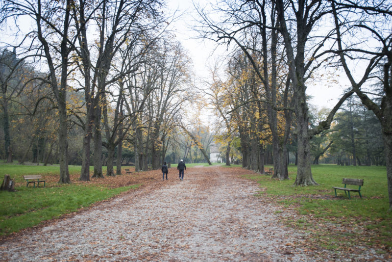
After you pass the Basilica, you descend the hill through a woodland and find yourself in the Talon Park. Here, you can see from above the Chiusa di Casalecchio, a dam constructed in the 13th century to make the river Reno merge towards the city.
Stage 3 – From Sasso Marconi to Monzuno
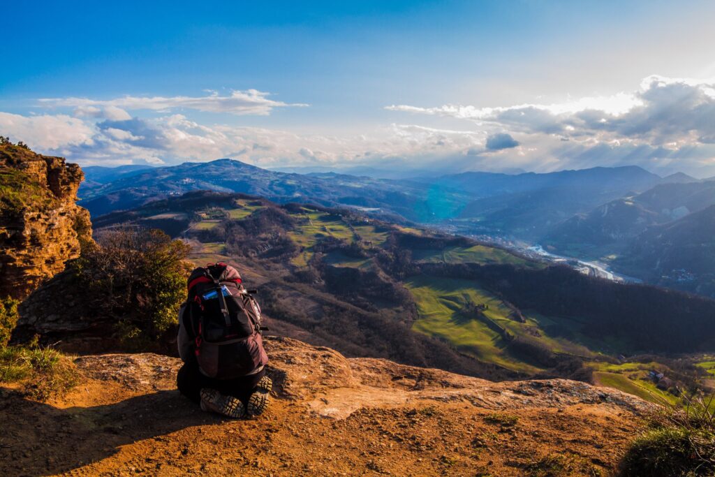
The Apennine part begins here, in the third stage. From Sasso Marconi (115 metres above sea level) you climb to reach the Prati di Mugnano and enter the riserva del Contrafforte Pliocenico. Here, you can easily find fossils and shells since this place was surrounded by sea water a few million years ago.
Then, you go on the Adone Mount (654 metres above sea level) where the landscape is breathtaking. We advise you to have lunch here. Then, after this quick rest, you get down to Monzuno.
Stage 4 – From Monzuno to Passo della Futa
This is the most demanding part. From Monzuno you climb to Monte Galletto (950 metres above sea level) among woods and ridges. Then, you go down to Madonna dei Fornelli (795 metres above sea level), where you can have a small break to rest before the steepest part. This stage is one of the most appreciated by the tourists that experience the Via degli Dei.
The path continues for three kilometers up to the Monte dei Cucchi (1130 metres above sea level) and Pian di Balestra, where the Via degli Dei meets the Flaminia Militare.
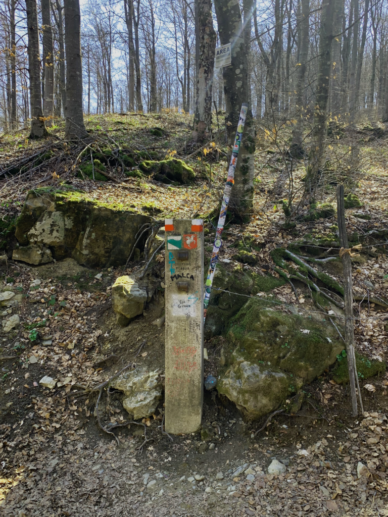
Here you pass the boundary between Emilia and Tuscany, where you can take a picture next to the cippus. Then, you descend and reach the Passeggere (1013 metres above sea level). In this stretch there is one of the few crystal springs, so we suggest you fill your flasks. Furthermore, here you can admire numerous roman findings.
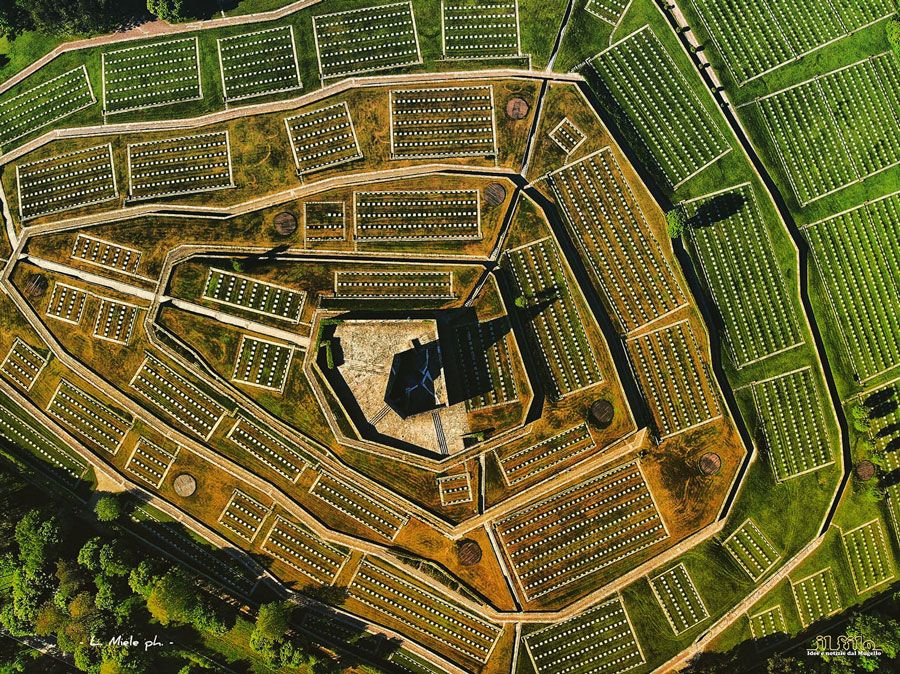
After, you climb to reach Poggio Castelluccio (1119 metres above sea level) and finally descend to get to the Passo della Futa (903 metres above sea level). Here, there is the biggest German war cemetery in Italy, that is in the shape of a spiral.
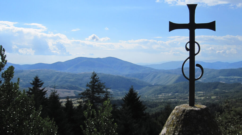
Stage 5 – From Passo della Futa to San Piero a Sieve
The path continues the ridge until it reaches the Croce di Monte Gazzaro. This specific stretch is not recommended for those who mountain bike and for everyone in case of bad weather.
Next to the cross there is a small stone structure that contains the peak book, on which anyone passing by can write their thoughts. Then you continue to follow the path and reach San Piero a Sieve.
Stage 6 – From San Piero a Sieve to Vetta Le Croci
From the historic center of San Piero a Sieve you continue following the path. If you want, you can take a little detour to see the Medici Fortress of San Martino (that however is closed to the public).
Then, you continue the Via degli Dei and not so far from Trebbio you can admire the beautiful view of olive trees. You pass Trebbio and the path makes a steep that will take you to the Convento di Monte Senario. Here, you can have a break at the friars’ refreshment point.
Then, continue on the road to Vetta Le Croci: an expanse of green fields with breathtaking views. If you are lucky with the weather, you can already see Fiesole and Firenze from afar.
Stage 7 – From Vetta Le Croci to Florence
You follow the road (that now is asphalted) until you reach Piazza Mino in Fiesole. If you continue the Via Vecchia Fiesolana after 6 km you will find yourself in Florence and can admire the beauties of this Unesco heritage city.
More details
If you’re intrigued by this challenging but beautiful journey, discover other walks and excursions thanks to which you will find yourself surrounded by nature and will see new enchanting territories.
Are you an enthusiast of mountain bike tours? You cannot miss the experience of riding the Ciclovia del Sole, from Bolzano to Bologna, for almost 300 km. You will pass through nature and some places of important historical value. Read also: Paths and Excursions in Bologna: 5 routes in the middle of Nature
Bibliography
- Agostini C., Santi F., La strada flaminia militare, CLUEB, 2000.
- Fazzioli S., La via degli Dei, Roma, Edizione dei Cammini, 2016.
- Frignani S., Guida alla via degli Dei. Da Bologna a Firenze e Ritorno, Milano, Terre di Mezzo, 2019.
- Lugaresi N., Una via differente: con 12 studenti, sulla via degli Dei, San Lazzaro di Savena, Bonamo, 2019.