

![]()
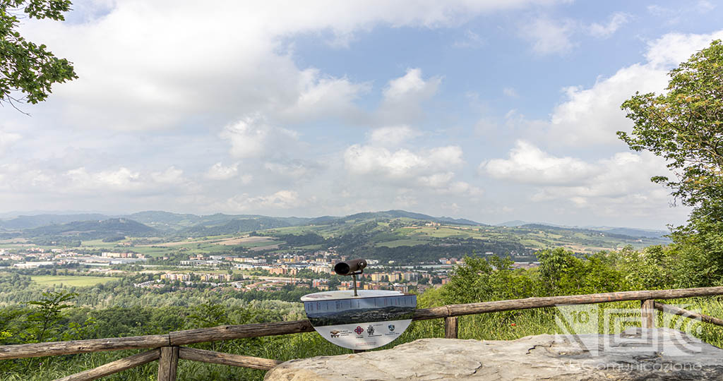
Are you looking for paths to immerse yourself in the green of the Bolognese hills? Continue reading the article and find out which one is right for you!
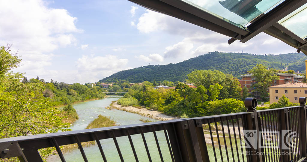
Via della Lana e della Seta
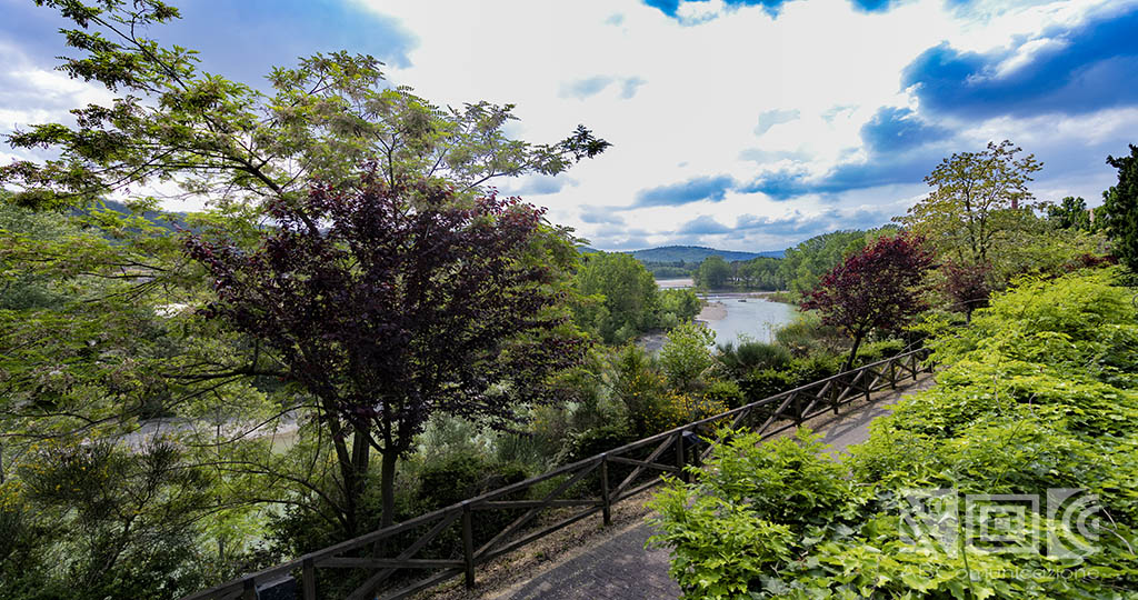
The Via della Lana e della Seta is a challenging route of about 6 days for 130 km that connects Prato to Bologna and vice versa, crossing the municipalities of Cantagallo, Vaiano, Vernio, Castiglione dei Pepoli, Camugnano, Grizzana Morandi, Marzabotto, Sasso Marconi, Casalecchio di Reno and Bologna: given the length it is usually divided into 6 stages of about 20 km each.
During the journey it is possible to stop in the numerous structures that offer typical local food and accommodation.
Why precisely Via della Lana e della Seta?
The name has been attributed to it as it was once the trade route between Bologna, famous for silk, and Prato, famous for wool.
This path can be traveled both on foot and by mountain bike: if you decide to follow it by bike, a good workout is recommended.
The Via della Lana e della Seta offers numerous breathtaking landscapes, where you cannot fail to stop: starting from Bologna you can admire Piazza Maggiore, via Riva di Reno, the former spinning mill and the Chiusa.
Continuing towards Sasso Marconi you will find the Ponte di Vizzano (Roman bridge that connected Rome and Florence to Bologna), Palazzo de ‘Rossi (read also The houses of the countryside of Bologna), the park of Monte Sole and the Mausoleum of Marconi.
Once arrived in Grizzana Morandi you can stop and observe Casa Morandi (where Giorgio Morandi, Italian painter and engraver lived), Rocchetta Mattei and Borgo la Scola.
In Castiglione dei Pepoli you cannot miss the immense Park of the Lakes as in Val di Bisenzio you cannot miss the Rocca of Cerbaia. Once in Prato, a stop at Cavalciotto (an example of industrial archeology), Palazzo Datini and Piazza del Duomo is a must.
Via degli Dei
Another route that concerns Bologna and Tuscany is the Via degli Dei: a path that starts from Bologna and arrives in Florence in Piazza della Signoria of about 130 km. It can be traveled both on foot and by mountain bike.
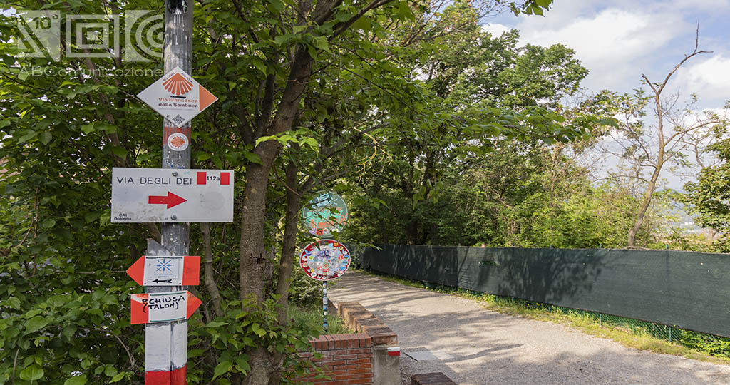
The Via degli Dei was conceived at the end of the 1900s by Bolognese hikers who wanted to recreate the road that in Roman times connected Bologna with Arezzo and Rome through the Apennines, called Flaminia Militare.
Starting from Bologna continue towards Casalecchio di Reno arriving in Sasso Marconi. From here take the path towards Monzuno and then towards Madonna dei Fornelli. Once in Tuscany you pass through Sant’Agata and finally arrive in Piazza della Signoria.
During the Via degli Dei it is possible to observe the Roman aqueduct, the oasis of San Gherardo, the botanical garden Nova Arbora, the largest German cemetery in Italy, the parish church of 1175, the Bosco ai Frati convent and the Trebbio Castle.
There are numerous inns and agritorurism along the route to rest and then resume the walk. Plus, many of these properties are pet-friendly so if you’re thinking of walking this six-legged trail, don’t think twice!
Eremo di Ronzano
Are you looking for a short and simple excursion? The Eremo di Ronzano is waiting for you!
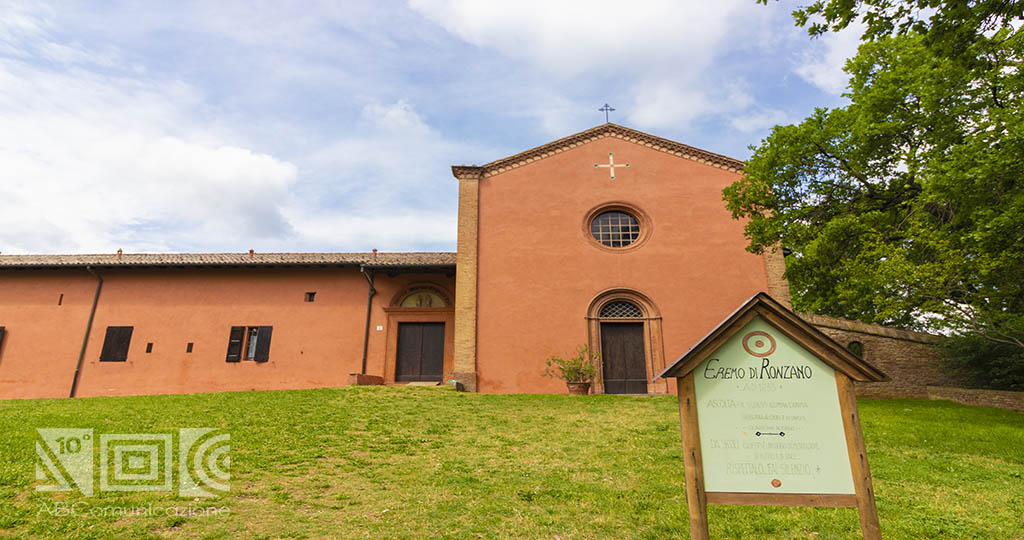
The itinerary is part of the CAI path n.904 and begins in St. dell’Osservanza. Continuing on, you arrive at the church of the same name of San Paolo in Monte dell’Osservanza; at this point it is necessary to follow the directions for path 904 which will lead to Villa Ghigi, crossing the park you will arrive at the Eremo di Ronzano.
It is said that in 1140 a Bolognese noble took refuge in Ronzano and founded a chapel there. Subsequently, in 1209, the great-granddaughter founded the church. The Hermitage can still be visited today.
If you love historic villas, we also recommend our selection of the most beautiful historic villas, both in the city center, both in province of Bologna!
If you want to continue, you will arrive at the church of San Michele Arcangelo di Gaibola.
This hike is about 3 km long and can be done in 45 minutes.
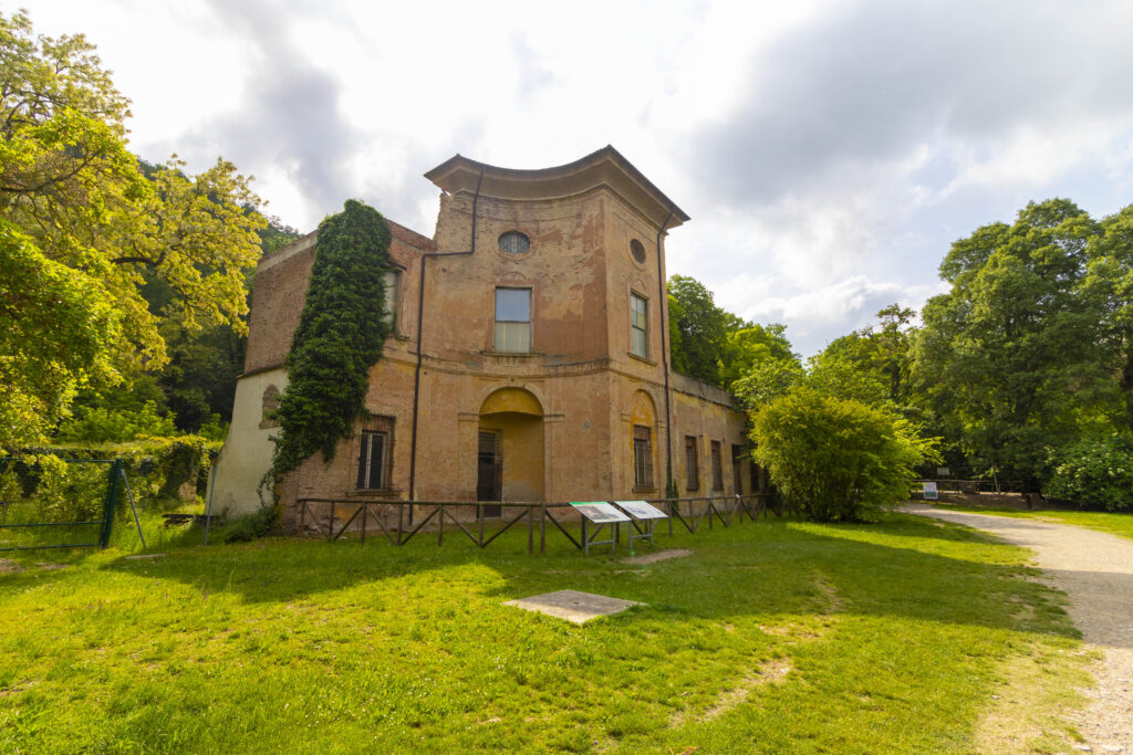
Sentiero dei Bregoli
The Sentiero dei Bregoli is a path that involves the Parco della Chiusa and the Sanctuary of the Beata Vergine of San Luca (read also The Sanctuary of the Madonna of San Luca between sacred and legend).
The path begins at the main entrance of the Parco della Chiusa: along the main road, you will find St. Panoramica on the left, to be followed until its end. From here continue with the Sentiero delle Montagnole which leads to Montagnola di Sopra: at this point you must keep to the right. Once in St. di San Luca, in a few minutes you will arrive at the Sanctuary of the Beata Vergine of San Luca. Here you will have a panoramic view over all of Bologna.
Along the way it is possible to see the remains of Villa Sampieri Talon, belonging to the Sampieri family, which was destroyed during the Second World War.
Once you arrive at the Sanctuary of the Beata Vergine of San Luca it is possible to choose whether to go down towards the center of Bologna under the porticoes (read also The porticoes of Bologna: UNESCO World Heritage) or whether to return to the starting point by taking the CAI 112/A path which arrives at the church of San Martino.
Where does the name Bregoli come from?
There are two legends surrounding the latter: the first narrates that, once upon a time, the citizens of Casalecchio used this path to look for bregoli or sticks of wood; the second, on the other hand, tells that the Bolognese pronounce this name “brigoli” which means impassable and gravelly.
The length of this route is about 3km one way and can last around an hour: it is suitable for everyone.
Quattro ponti sul Reno
Are you looking for an intermediate level path? This can do for you!
The “Quattro ponti sul Reno” route starts from the spinning mill located in St. Dei Canonici Renani in Casalecchio di Reno, crossing the first bridge built over the Garibaldi district. The second bridge you meet is the Ponte della Pace: once you have crossed it, you pass under it until you reach the bridge over the Reno in St. Porrettana.At the end of the latter, you will find yourself in Piazza del Monumento ai Caduti where there is a pedestrian path that ends at Lido di Casalecchio. From St. Ronzani it is necessary to pay attention to a sign indicating the presence of a footbridge: crossing it will begin the return path through the Parco della Chiusa to San Martino and following the cycle path you will return to Bologna.
The length of the entire route is about 9 km, which can be covered in 3 hours, without the need for prior training.
Did you like these routes? What are you waiting for, backpack and enjoy the green of Bologna’s nature!
Bibliography:
- Cervigni P., Guida dei sentieri dell’alto Appennino bolognese-toscano dal Passo della Futa al Reno, Carpi, Il Sentiero, 2019.
- Cervigni P., Il sentiero degli dei. Da Bologna a Firenze, Rimini, L’Escursionista, 2016.
- Lenzi Bonfiglioli V., Bologna dalla parte della collina. 14 itinerari storico-culturali adatti a tutti, Treviso, Editoriale Programma, 2018.
- Paticchia V., Via della lana e della seta. A piedi da Bologna a Prato. 130 km a piedi in 6 tappe da Bologna a Prato, Cuneo, Fusta, 2018.